Yesterday, for the third time, I started down a favorite loop just off the Skyline Drive in the Shenandoah National Park. Weather was beautiful - temps perfect, clear skies.
The first time I attempted this run was in late May of 2008 and everything was blooming along the trail.
[click photos to enlarge]

The loop is about 15 miles up Skyline Drive from 64, about 20 miles from Charlottesville. I park at the Wildcat Ridge area, cross the AT, head down Wildcat Ridge, catch the Rip Rap Trail and then take the AT back to the parking lot. It's about a 9 mile loop, with some nice climbs and fairly technical stretches, strewn with rocks and roots.


(Photos taken in late May 2008)
Views are fantastic, particularly from the Cathedral Rock and Chimneys area. You can see the valley heading over to Harrisonburg and also take in views of the Massanutten area.
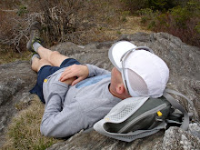
On my first attempt, I was trapped by a wicked thunderstorm...

...and had to spend about an hour huddled in the overhang of a cliff that hikers had surrounded with stonewalls.

...and had to spend about an hour huddled in the overhang of a cliff that hikers had surrounded with stonewalls.

I often marvel at how each trail run can be different due to seasonal shifts. Prior outings in this area were after the leaves were on the trees and the trail was shady and lush. This time, however, I was ahead of the canopy and the trail was doused in sunlight. The feeling was entirely different, and I stopped at one of several stream crossings to watch the light play on the water. (Perfect swimming hole for a summer outing)


I encountered several sets of backpackers. We chatted a bit. One group had seen a bear earlier that morning, so, the bears are awake (something for us to keep in mind when we head up to the Art Loeb in a couple of weeks.) My cell phone went off somewhere along the trail. Duncan had texted me with news that he had taken first place at the Inaugural Mountains to the Sea Trail run in Durham. He said the trail was nice and pretty fast. Sounds like he had fun. As I was putting my phone away I looked down and noticed a little friend on the trail, so, while she held her pose, I took her picture.

This is a lovely outing. Anytime you're in the area it's worth a trip over to do this very manageable loop. Just start down the path from the parking lot, cross the AT and follow the blue blazes. Keep your head up when you come to the 2nd stream crossing, the trail juts left around a switchback. If you go straight you'll wind up in that shelter mentioned above.
Take your camera and capture some of the views from the higher points (something I didn't do this time, but will do the next).
Here's the GARMIN route.
Here's a link to maps of the Skyline Drive.
Here's the GARMIN route.
Here's a link to maps of the Skyline Drive.
Nice report Squonk, this trail looks great!
ReplyDelete-grit